|
The townland of Drumlamph, which covers just over 1147 acres, is in the Province
of Ulster in the County of Londonderry, Northern Ireland.
The area is also known as Mid-Ulster.
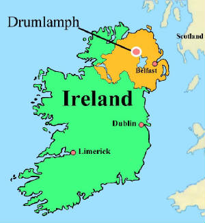
Dumlamph is in the Barony of
Loughinsholin and in both the parishes of Maghera and Lavey.
It is situated about 6km (4 miles) from the north west corner of
Lough Neagh, 2km (1.25miles) north west of Castledawson and 2km (1.25miles) west of Bellaghy.
Map of Northern Ireland
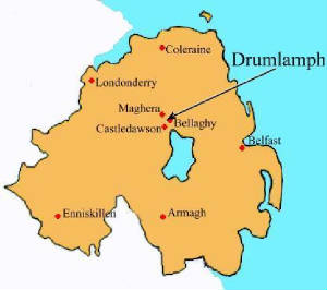
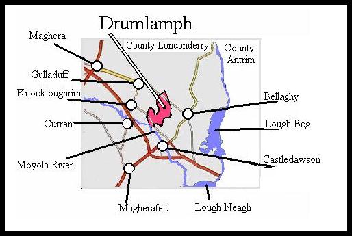
Other nearby towns and villages are Magherafelt, Maghera, Knockloughrim, Gulladuff
and Curran.
At its southern tip the Moyola River forms part of the townland's boundry.
Map of Drumlamph
Neighbouring townlands are 'Rocktown' and 'Ballymacpeake Upper' also in the Parish
of Maghera; 'Mullaghboy', 'Killyberry Boyd', 'Killyberry' and 'Tamniaran' in the Parish of Ballyscullion; 'Lemnaroy' and 'Broagh'
in the Parish of Termoneeny, and just across the Moyola River 'Ballynocker' in the Parish of Magherafelt.
|


