|
'The history of Drumlamph and its people' is my own personal project,
and is to record as much information about the townland and all the families that have lived there during the 19th and 20th
centuries.
Over the past 200 years, many families have lived in the townland, some for only a short time, others have
remained, (some on the same farm) for the last two centuries. This project is to make a record of as many of these families
as possible. This will include things like when families moved into and out of the townland, where they lived, what other
families in the area they were related to, where these families came from, where their descendants can be found today etc..
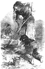
During the years spanning the 'Potato
Famine' (1845-1852) the population of Drumlamph dropped by almost a quarter. While some died, many emigrated to escape the
famine. Where possible I would like to record where some of these people went.
For more information about 'The Potato Famine' click here
Like most townlands, Drumlamph has its fair share of local/old names
for roads, lanes, houses, fields etc.. These old names are gradually dissappearing from the townlands throughout Ireland,
perhaps in a few generations the townland names themselves may also be a thing of the past.
In Drumlamph in recent
years the 'Wee Road' has been renamed 'Drumlamph Lane' the 'Moss Road' is now called 'Drumlamph Road', and the 'Double Corpse
Wood'/'Corpse Wood' (pronounced 'Copy') has been given the new name of 'Drumlamph Wood'. (which causes confusion with another
wood of the same name and also a few miles from Maghera). Other names like 'Cottage Farm', the 'Bog Lonnan' the 'Whinney Car
Road' the 'Bull Hole Field' 'Island Burn' 'Pimley's Wood', Pedlow's Brea' etc have almost been forgotton altogether.
Our
forefathers, the people that lived and worked in the townlands, gave these places their names. These names often reflected
the character of the townland at that time, and are therefore part of the history of the area. In most cases these changes
are made by the current population, and, like the old names, say something about the area, and in due course these names become
part of the townland's character.
However with new postal addresses, post codes, computerised records etc., some of
these 'modern' names have been 'thought up' by people who have never even visited the townland, and therefore say nothing
about the area. One of the aims of this project it to record these names before they are lost forever.
Throughout the townland there are a number of ruins of
old homesteads, many have not been occupied in living memory, others have totally dissappeared. It is hoped that this project
will identify which families lived in each house, and when they lived there.
All aspects of life in Drumlamph will be recorded,
local events, damage caused by 'The Big Wind' of 1839, local characters, stories about the area (fact, fiction, true or untrue)
myth's, suprestitions etc.
Over the years a number of items of historical interest
have been found in Drumlamph, old coins (some dated 1575) crocks of butter, a brass sword, quern-stones etc. Where are these
items now or do you know of any other finds?
I would like to hear from anyone who has any information
about the area, however little. If you are researching a family that have connections with any of the neighbouring townlands,
Bellaghy or Castledawson area, please get in touch. Who knows, I may have some information about your family.
In short, this project is to make a unique historical record
about the people and the history of the townland of Drumlamph.
|